
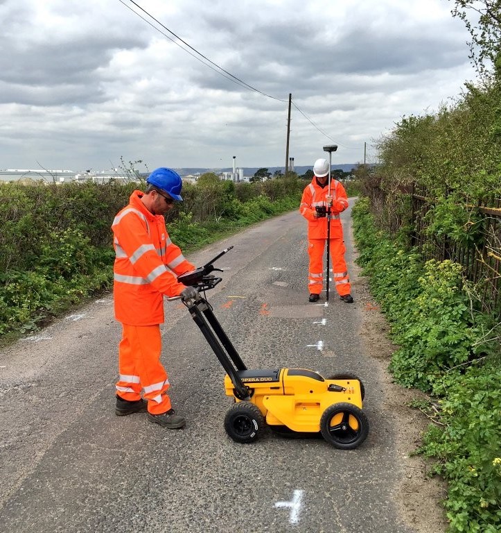
Underground Utility Survey
The failure to identify the locations of buried services before a development takes place can result in increased project costs and delays such as re-routing services. An Underground Utility Survey also minimizes the risk of serious health and safety implications while on site works take place.
What is Underground Utility Survey Mapping?
In the process of planning and executing both design and construction work, determining the precise location of utilities is critical. Underground Utility Mapping, Underground Services, and Topographical Surveys by GeoSpatial Survey provide a comprehensive understanding of infrastructure both above and below ground.
We offer a broad range of underground survey and utility mapping solutions across the UAE, including Dubai, Abu Dhabi, and Sharjah. Our services help in locating, identifying, and mapping all utilities and repair routes, including gas, water, telecommunications, electricity, and drainage, using cutting-edge technology and advanced tracing methods.
Ground Penetrating Radar (GPR) enables us to locate metal and non-metal pipes, as well as detect buried services, voids, and ducts with high accuracy within the designated location plan.
Benefits of Using GeoSpatial Survey's Utility Detection Surveys:
✅Reduce the exposure to buried hazards
✅ Non-intrusive survey – minimizes site disruption
✅ Reduces the need for intrusive investigations like slit trenching
✅ Minimizes risk and enhances safety
✅ Provides a more comprehensive assessment compared to slit trenching
✅ Ensures confidence before excavation works commence
✅ Complies with health and safety regulations
✅ Uses the latest survey equipment and software
✅ Provides an accurate record of underground utility depths and locations
With GeoSpatial Survey, you gain precise utility detection, ensuring your projects progress smoothly while minimizing risks and delays.
Underground Utility Survey
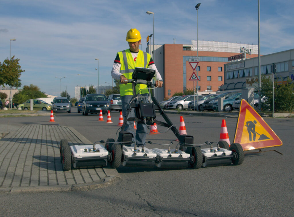
Stream-C is a compact array solution designed for real-time 3D mapping of underground utilities and features. It provides high-resolution subsurface imaging, enabling accurate detection and visualization of buried infrastructure.
With GeoSpatial Survey’s advanced underground utility survey solutions, Stream-C enhances the efficiency of locating and mapping utilities, pipelines, voids, and other underground structures, ensuring precision and safety in excavation and construction projects.
Underground Utility Survey
Underground utility surveys provide detailed insights into subsurface infrastructure, ensuring accurate mapping and documentation. The deliverables typically include 2D plan outputs that illustrate the layout of underground networks, along with 3D wireframe and model drawings that offer a more precise visualization of structures, chambers, and utility networks. GIS outputs are also provided to integrate geospatial data, making it easier to analyze and manage utility information. Additionally, geo-referenced manhole photography captures visual documentation of underground access points, while longitudinal and cross-sectional views offer a deeper understanding of pipework and other underground features. Detailed reports accompany these deliverables, ensuring that all findings are thoroughly documented for effective planning and decision-making.